 Looks like it won't be making landfall in FL until Monday morning. It has slowed so much over the Yucatan. I feel really sorry for the people who live there, having a Cat 3 hovering overhead for 24 hours. What a nightmare! One of the usual blessings of a hurricane is that it blows through fairly quickly. When it sits like this, it just gives the wind and rain more time to do damage.
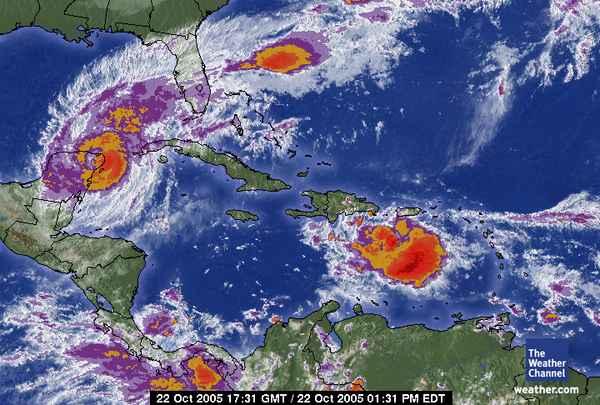
It's expected to make landfall down around Naples sometime on Monday morning as a Cat 2, but the exactly location of where it hits all depends on when it turns East. We've already been getting scattered showers from the outermost part of it over the past 2 days. This is one massively large storm! The rain bands are stretching out as far as maybe 100 miles or so North of the Bahama Islands it looks like, and a high surf advisory for boaters has already been issued for the the Tampa area. I borrowed the image here from The Weather Channel's website.
I'd also like to mention that yesterday, Senator Bill Nelson of Florida went up in the Hurricane Hunter G-IV airplane for an 8-hour trip above the eye of Wilma. I couldn't believe they let him do that! He's a good senator and has a respectable voting record (according to me). We don't need to be risking his life like that. But he went up because he used to be an astronaut, so I guess he could handle it, and he was actually working, doing storm calculations and stuff.


No comments:
Post a Comment